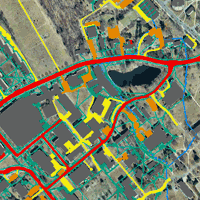
step 1 - Examples of different types of IC maps
No Digital Data
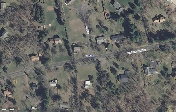
If you’re not that lucky: For those towns with no digital “planimetric” (footprint of buildings, roads, and other features) data, you will most likely have to digitize your impervious cover from high resolution aerial photos. Fortunately, Connecticut has recent (2012) high resolution (1 meter) statewide imagery, accessible from CT ECO. See the video on using CT ECO to access the imagery. As you can see, the imagery is “leaf off” and of sufficient resolution to easily make out roofs, driveways, and other impervious features. Digitizing is a specialized skill, and must be done by an experienced contractor, staff person, or volunteer.
 |
Parcels & Building Footprints
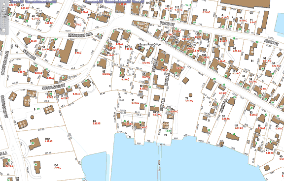
If you’re kind of lucky: Many towns have building footprints (together with parcels) related to their assessor’s database. This online example from Essex shows roads/rights of way and buildings. This data exists digitally (often with a contractor), and can be used by the town to complete those pieces of the impervious pie. Parking lots, sidewalks, driveways and other impervious surfaces must still be digitized, however.
 |
Parcels, Building Footprints & Other Features
If you’re lucky: your town has planimetric data, with all the impervious cover components digitized. In this example from the Town of Saybrook, brown areas are roof, dark gray roadways, and light gray parking lots and driveways. It’s unclear whether the dataset includes separate categories for these last two impervious components, but that’s not absolutely necessary (see next example for an even more complete set).
 |
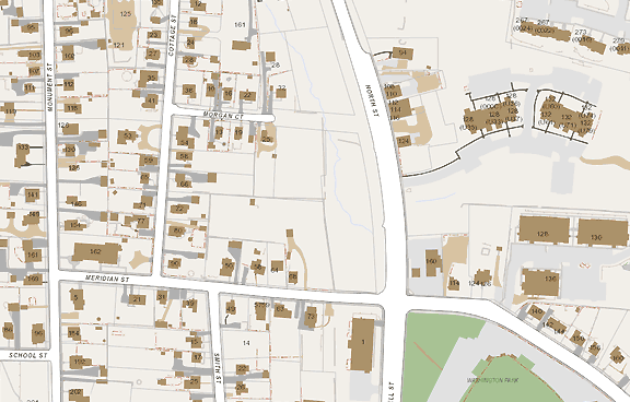
Complete "Planimetric" Data
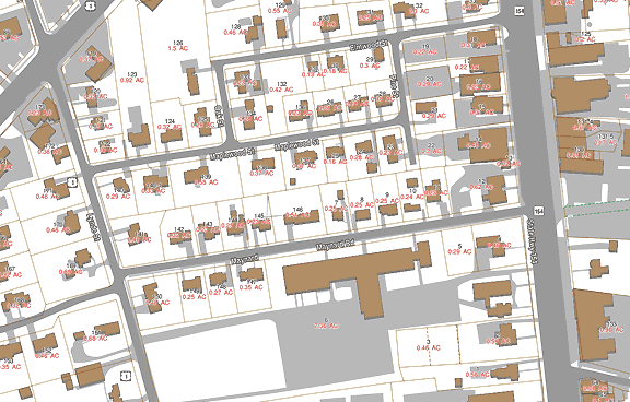
If you’re very lucky: your town has complete planimetric data with all the impervious cover components digitized and in separate categories. In this example from the Town of Groton GIS website, brown areas are roof, dark gray driveways and walkways, light gray parking lots, and white areas roads. That’s pretty much all you need!
 |
Towns with State IC Data
If you’re one of the chosen few: you are located in a town or watershed for which the state has recently acquired high resolution impervious cover data, derived from the 2012 statewide aerial imagery. Use the interactive map below to explore the watersheds that have this data.
| View Larger Map |


