Step 7 - General Documentation
It is a good idea to document all the retrofit and new projects. This includes keeping a record of the site plans and the dimensions of the IC involved in the project, as well as taking photographs at various stages of the construction/redevelopment.
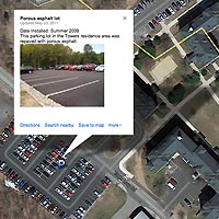
There are many ways to do this. For the Eagleville Brook project, we decided to track implementation primarily through the use of a “mashup” web map, which you can create yourself using GoogleMaps®. Photos, documents, and other information can be linked to the specific sites [learn about mashups through CLEAR’s Geospatial Training Program.]


